By Mary Kasoka Mwiikisa
Zambia launched its National Adaptation Plan (NAP) in November 2023, a document meant to offer a holistic approach to climate change adaptation activities in Zambia.
This blueprint is also a requirement by the United Nations Framework Convention on Climate Change (UNFCCC) for member countries.
Following this launch, the Government of Zambia is transitioning from planning to implementing the priorities in the National Adaptation Plan.
With Zambia’s President Hakainde Hichilema declaring the El Niño induced drought a national disaster and emergency, there has been heightened drought response measures in the country’s key sectors.
Pemba district is located in the Southern Province of Zambia, about 251 kilometres from the capital city, Lusaka. This is a predominantly agricultural District with crop and livestock production at the centre of the livelihood of many households. The current drought that Zambia is experiencing has left a trail of destruction, prompting adaptation actions in line with the National adaptation plan.
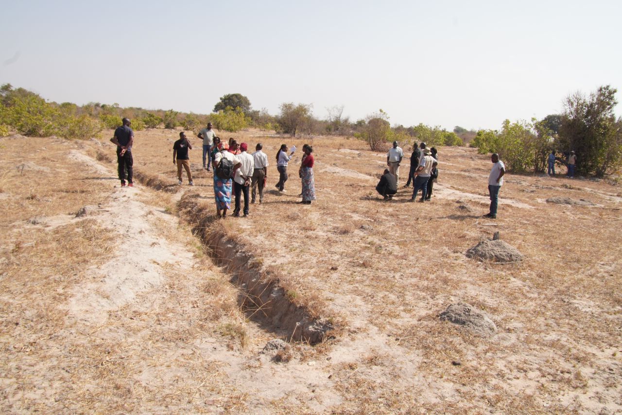
In Magoye and Bweengwa catchment sites, the communities have dug trenches in delineated areas to restore water recharge systems. The trenches measuring at most five meters in length and one meter in depth are used to trap underground water and surface rain water to minimise soil erosion and water loss.
Water Users Association (WUA) and Community Protection Measures (CPM) Supervisor in the Mutama Bweengwa area, Likolo Namushi hopes the community measures will improve water availability in the area which is mostly affected by soil and gully erosion. “We have dug these trenches to help the community have access to water by recharging the natural resource, we also have a challenge of land degradation due to gully erosions that often happen in Bweengwa, therefore, we have mobilised ourselves to build Weir dams across the gullies to regulate water flow during the rainy season and ultimately allow the gully to get buried naturally,” Mr Namushi said.
This scenario is similar to the Magoye catchment area. Of particular interest to the community is the restoration of the source of the Magoye river which has since dried up. The members of the Water Users Association and Community Protection Measures in Magoye have intensified digging trenches to recharge the Magoye headwaters source.
“As you can see, most parts of Magoye’s vegetation has dried up, with no grazing land for livestock, however this location where we have some significant greenery because of the trenches we have dug. Even with the little rainfall we received during the last rainy season, the trenches were able to trap surface and underground water which is recharging the area,” said Precious Mweemba, a member of the Water Users Association of Magoye catchment area.
The community efforts in Magoye are being challenged by the customary land management system. Despite by-laws enacted to protect the source of the headwaters, enforcement remains a challenge as villagers are encroaching on the protected recharge area. Headman Robert Mweemba Handyabantu of Magoye says many villagers on several occasions have attempted to build houses around the recharge area because of the green vegetation. However, such a practice jeopardises the adaptation actions being carried out there.
“The villagers find this place attractive to build their houses on due to the vegetation which is here. They are seeing it as a solution to their livestock grazing needs. As members of WUA, we ”ve asked the traditional leadership to intervene and sensitise the community on the need to restore the Magoye river system, a river which when restored will benefit all,” said Headman Handyabantu who is also a CPM supervisor.
These adaptation measures taking place in Pemba district are part of the Accelerate Water and Agricultural Resources Efficiency (AWARE) programme meant to enhance climate-smart water resources management and efficient agricultural water use for smallholder farmers in the Lower Kafue Sub-Catchment, ensuring a gender-sensitive approach.
To achieve the objective, AWARE works at the national as well as decentralised level on water resources management and supports more than 11,000 smallholders in the sub-catchment to improve their agricultural water management practices.
Wesford Mudenda, who is the Water Resources Management Governance Advisor to GIZ in the Lower Kafue catchment says the project has delineated 550 hectares headwaters protection area in Magoye and works with the community to protect the recharge zone from bush fires, encroachment and deforestation.
“The Lower Kafue Sub-Catchment administratively spans across parts of Southern, Central and Western Province and is particularly affected by climate variability in this regard,” Mr Mudenda added.
The field visit to Bweenga and Magoye was meant to appreciate the adaptation works being undertaken in line with Zambia’s National Adaptation Plan.
This was part of the Peer-to-Peer Exchange Learning Workshop organised by the NAP global network and the Government of Zambia, where the Namibian Government sent representatives to Zambia to learn and appreciate the Zambia National Adaptation Plan development process as Namibia embarks on the development of its own NAP.
The lessons learnt focused on the impact the adaptation actions are having on communities in Zambia and how they can build climate resilience.
